

This vistas aren't going to climb themselves
12 Best urban hikes in San Francisco Bay Area (2025)

we have access to. Obviously we’re surrounded by water – basically an island. But our beaches aren’t to rival cities like San Diego, but our accolades lie in green spaces and hikes. We have 224 sq ft of green space per resident, placing us above both Chicago and New York, 220 neighborhood parks, and 4,000+ acres of recreational and open space.
And if you’ve ever walked around this city, you know that it’s super steep. San Francisco packs 74 named hills into just 47 square miles, making it the second hilliest major city in the world after Hong Kong.
This topographical phenomenon makes for great Instagram shots, a sweaty bicycle commute, and unlimited urban hikes.
Some of Northern California’s finest climbs uncurl right from the city’s doorstep, ranging from coastal cliffs and wildflower-carpeted hillsides to redwood forests and windswept bluffs.
Avid trekkers looking for steep climbs and casual strollers just wanting a pre-brunch ocean view will both find that the city trails deliver.
So what are the best urban hikes in San Francisco in 2025?
Check out this is insider’s guide the 12 most remarkable routes of all difficulty levels, inclines, and unique features.
This is perhaps the city’s most iconic hike. Land’s End Trail follows a rugged stretch of cliffs along the northwest edge of San Francisco, with views of Alcatraz, Marin Headlands, and the Golden Gate. The terrain is mild, with wide dirt paths, wooden stairs, and hidden WWII artifacts. The trailhead is at the historical ruin, Sutro Baths, and you may or may not find a stone labyrinth on the way, ending at Eagle’s Point.
If you’re super adventurous, take the unsanctioned path past the end of the trail past Eagle’s Point, walking down through glitzy neighborhood Sea Cliff, down to Baker’s Beach (watch out for nudists!), and over to Fort Point. The tide was low when we did it, I’m not sure you can do it otherwise. Be careful for this and also the nudist at Baker Beach will definitely be doing sex things so don’t bring kids with you. We climbed over the fence at Fort Point, onto the other side and kept going all the way to the Marina, but it’s probably not legal so do it at your own risk.
Difficulty: Easy to moderate
Distance: 3.4 miles (loop)
Elevation Gain: 538 feet
1.5–2 hours walking without stopping
When to go: Catch the trail early in the morning for magical fog-draped views
Location: In the Outer Richmond neighborhood – park in the Lands End Lookout Parking Lot or the Legion of Honor Parking Lot to start on the other side
Where to eat after: Park Chalet – cute outdoor seating brunch spot on the edge of Golden Gate Park and Ocean Beach
Batteries to Bluffs Trail
This is shorter than Land’s End, hugging the coastal bluffs of the Presidio with sweeping views of the Golden Gate Bridge and the Marin Headlands, but packed with drama: sandy staircases, tucked-away beaches, historic military batteries, and plenty of photo opportunities. You’ll start near the Golden Gate Overlook or Lincoln Boulevard and descend toward Marshall’s Beach, where you may or may not spot daring sunbathers (again, they will be naked) enjoying the seclusion.
Because it’s part of the Presidio, the trail is well-maintained but expect steep sections with lots of stairs. Be prepared for some huffing and puffing on the climb back up, but the views are absolutely worth it. It’s one of the best places to get close to the bridge without the crowds of the main viewpoints

Difficulty: Moderate (steep stairs, sandy paths)
Distance: 0.7 miles one way (1.5 miles out-and-back)
Elevation Gain: ~226 feet
30–45 minutes walking without stopping
When to go: Late afternoon for golden light and epic sunset views over the Pacific
Location: In the Presidio – start from the Golden Gate Overlook or along Lincoln Boulevard near Langdon Court Parking Lot
Where to eat after: Warming Hut Caf̩ Рa cozy waterfront spot at Crissy Field for coffee, sandwiches, and snacks with a view of the bay
Twin Peaks
You’ve seen Twin Peaks. In that TV Show, and also just driving around the city – it’s that double peak with the Sutro Tower on one of them, usually completely covered in fog. The first time I hiked Twin Peaks it was so foggy we couldn’t see Sutro Tower, and it was so windy that I was literally afraid I was going to fall off the side of the cliff. Now I text my brother to get a weather report first, because he can see the peaks from his living room window.
It’s a short but steep ascent that delivers a gorgeous 360-degree view of the city, from downtown’s skyscrapers and Golden Gate Park to the Pacific and, on clear days, you can see Mount Diablo.
Difficulty: Moderate
Distance: 2.1 miles (loop)
Elevation Gain: ~300 feet
1–1.5 hours walking without stopping
When to go: Sunset for panoramic city views and over the Pacific
Location: In the Twin Peaks neighborhood, street parking is available near Christmas Tree Point Road or at the Twin Peaks Boulevard turnout. If you’re really lazy, you can actually just drive to the top.
Where to eat after: Anchor Oyster Bar – a cozy Castro spot serving fresh oysters, clam chowder, and seafood classics. Get a res, the place is tiny and popular.
Marin Headlands: Coastal Trail

The Marin Headlands Coastal Trail runs along the western edge of the Headlands from Muir Beach in the north to Rodeo Beach in the south, and feels like stepping into another world, with redwoods over 1,000 years old and more than 250 feet tall. I went here for my 5th-grade field trip and now I go to get out of the city and get some fresh air and some exercise.
This expansive network of paths traverses rolling hills and dramatic cliffs with panoramic views of the Golden Gate Bridge and San Francisco skyline. Come in spring and there will be wildflowers blanketing the hillsides, raptors stalking prey abovehead, and those large grey heron-looking birds. The hike is kind of a choose-your-own-adventure situation. You can cut in and out, choosing shorter loops if you’re just hopping in for a pre-brunch jaunt, or taking longer circuits to Marin Headlands Lookout or Point Bonita Lighthouse if you’re in it to win. Don’t miss the labyrinth.
Difficulty: Moderate – some steep climbs and exposed coastal sections
Distance: ~7 miles one way, Muir Beach → Rodeo Beach (can be as short as you want with the loops)
Elevation Gain: ~1,785 feet total (lots of rolling hills)
3–3.5 hours walking without stopping
When to go: Clear mornings for the best Golden Gate and ocean views; afternoons can be windy and foggy. Also, parking starts to fill up as the day goes on.
Location: Marin Headlands, part of Golden Gate National Recreation Area – park at the Coastal Trailhead near Muir Beach for a north-to-south option
Where to eat after: Hook Fish Co. in Mill Valley – fresh, sustainably sourced seafood in a laid-back coastal setting

Dawn Falls Trail

This is Marin County’s hidden gem hike, tucked into the redwood-filled Baltimore Canyon Preserve in Larkspur. The trail winds along a shaded creek bed before climbing gently through lush ferns and towering redwoods to Dawn Falls, a seasonal waterfall that gushes in the winter and spring but slows to a full stop in the summer. Last time I did this hike, in August 2025, the was nothing but dry creek beds, but the forest atmosphere makes this hike Secret Garden-magical.
The loop combines several interconnected trails, so you can make it as short or long as you like. We did a 4-mile loop, moderate in difficulty, and with some East Bay views at the top. Dogs are allowed on-leash, and the shaded paths make it a great choice on warmer days. In the spring, you’ll find wildflowers along the way, while autumn brings golden leaves scattered across the forest floor.
Pro tip: Go ahead and park a little far from the trailhead so you can take in the incredible houses of this neighborhood. They look mansions that very affluent fairies would live in.
Difficulty: Easy to moderate
Distance: ~4 miles (loop)
Elevation Gain: ~600 feet
1.5–2 hours walking without stopping
When to go: Winter or spring for the best waterfall flow; mornings for quiet trails and cool shade
Location: Larkspur – trailhead starts at the end of Madrone Avenue in the Baltimore Canyon Preserve (limited street parking available)
Where to eat after: World Green Bowl Juice – no joke the best bowl any of us had ever had, then put Keiko Sushi in your nav and go check out this super cute area (I haven’t made it over there yet but it’s adorable).

Mount Sutro Open Space Reserve

Tucked between the Inner Sunset, Forest Knolls, and Cole Valley neighborhoods, this urban hike is basically a magical forest in the heart of the city. The reserve is 61 acres – managed by UCSF. It’s a steep eucalyptus forest under shaded trails, including the Historic Trail, Fairy Gates Trail, and North Ridge Trail, where ferns and fog carpet the slopes.
The dense canopy keeps the reserve cool year-round, and after light rain, the air fills with the scent of eucalyptus and petrichor. Despite its central location, Mount Sutro is quieter than the other city hikes, making it perfect to get away and clear your head or go birdwatching.
Difficulty: Moderate – some steep and narrow trails
Distance: ~5 miles of interconnected trails
Elevation Gain: ~400 feet
2–2.5 hours walking without stopping
When to go: After light rain for the freshest eucalyptus scent and lush greenery – or when you want to get away but you need to be back after lunch break.
Location: Between Inner Sunset, Forest Knolls, and Cole Valley – street parking available on Medical Center Way or Woods Lot.
Where to eat after: Crepes on Cole – a cozy neighborhood counter service spot serving sweet and savory crepes, coffee, and brunch classics
Pro tip: This area can be muddy in winter and spring, so don’t bring your white sneakers.
Bernal Heights Park

Bernal Heights Park is one of San Franciscans’ favorite urban hikes, giving us sweeping 360-degree views without needing to leave the city (which we hate to do). A winding dirt trail loops around the grassy hill, steadily climbing toward a rounded summit that overlooks the downtown skyline, the Bay, and distant peaks like Mount Diablo. On clear days, the view stretches for miles, but foggy mornings, while giving us less visibility, bring an ethereal mood to the surrounding landscape. You’ll see photographers, dog walkers, and WFH locals trying to squeeze in a lunchtime nature escape steps from their front doors.
Because the loop is short, it’s an easy addition to a morning or afternoon outing, but the incline still gives you a little cardio boost. The trail is fully exposed, so the experience shifts dramatically with the weather – sunny days bring wide-open blue skies, while windy evenings can be brisk. Sunset is particularly magical here – there’s nothing like swinging away an evening as the city below slips from a golden glow to a twinkling nightscape.
Difficulty: Easy to moderate – short but steep climb
Distance: ~1 mile loop
Elevation Gain: ~150 feet
30–45 minutes walking without stopping
When to go: Sunset for a 360° city panorama with warm light
Location: Bernal Heights neighborhood – free street parking on Folsom Street or near the park entrance at Bernal Heights Boulevard
Where to eat after: La Taqueria – legendary Mexican spot known for its award-winning, no-rice Mission-style burritos
Grandview Park & 16th Avenue Tiled Steps

This short-but-steep urban hike begins with a piece of public art: the 16th Avenue Tiled Steps. Each riser is decorated with a colorful mosaic depicting sea life, flowers, and celestial patterns. The stairs lead directly into Grandview Park, a sandy, wind-swept hill crowned with a small viewing platform. From here, the city unfolds in every direction – Ocean Beach and the Pacific to the west, Golden Gate Park stretching north, and the pastel houses of the Sunset District below.
Despite its modest size, Grandview Park feels wild at the top, with hardy native plants and sandy soil underfoot. The climb is rewarding without being overly taxing, and the combination of public art and sweeping views makes it an ideal quick adventure for visitors and locals alike. Clear days offer crisp ocean vistas, while fog adds a moody, cinematic quality to the view.
Difficulty: Moderate – steep stair climb
Distance: ~0.5 miles out & back (stairs + park loop)
Elevation Gain: ~150 feet via steps
20–30 minutes walking without stopping
When to go: Late afternoon for golden-hour views toward the ocean
Location: Inner Sunset neighborhood – street parking on Moraga Street or 16th Avenue
Where to eat after: Arizmendi Bakery – fresh sourdough pizza slices and pastries
Corona Heights Park

Rising sharply above the Castro, Corona Heights Park is a rugged outcrop that feels like a little slice of wilderness in the city. The trail to the summit is short but steep, culminating in a rocky scramble that rewards hikers with some of the most unobstructed 360-degree views in San Francisco. From here, you can see the downtown skyline, the Bay, Twin Peaks, and the hills of Marin, all framed by open skies.
The park’s exposed terrain – mostly chaparral and dry grass – means there’s little shade, so it’s best to go early on sunny days. Because it sits right above the Randall Museum, it’s easy to combine a hike with a cultural stop, and the summit’s position makes it an exceptional spot for both sunrise and sunset.
Difficulty: Moderate – rocky climb at the top
Distance: ~0.5 miles (out & back)
Elevation Gain: ~150 feet
20–30 minutes walking without stopping
When to go: Clear mornings before the heat
Location: Corona Heights / Castro – street parking on Roosevelt Way or near the Randall Museum
Where to eat after: Kitchen Story – brunch with famous “Millionaire’s Bacon”
Glen Canyon Park

Glen Canyon Park feels like a natural sanctuary carved into the heart of San Francisco. A deep, rugged canyon cuts through the landscape, with grassy meadows, rocky outcrops, and a gentle creek running along the valley floor. The park’s trails meander through a mix of native plants and open space, providing a peaceful retreat from the surrounding residential neighborhoods. If you’re lucky you’ll see red-tailed hawks circling overhead.
Use Glen Canyon as a starting point for connecting to larger neighborhood walks toward Twin Peaks or Glen Park’s charming commercial district.
Difficulty: Easy to moderate – mild canyon trails
Distance: ~1.5 miles of loop trails
Elevation Gain: ~150 feet
30–45 minutes walking without stopping
When to go: Spring for wildflowers and green hillsides
Location: Glen Park neighborhood – free parking at the Elk Street entrance or street parking nearby
Where to eat after: Glen Park Station – casual local bar and grill
Buena Vista Park

As San Francisco’s oldest park, Buena Vista is a tangle of shaded trails winding up a steep hill in the Haight-Ashbury neighborhood. The park’s name means “good view,” and it delivers. At the summit, you can see downtown skyscrapers, the Bay, and the Golden Gate Bridge – framed by dense redwoods. Along the way, the switchback paths are lined with eucalyptus, cypress, and redwoods, giving the hike a lush, woodland feel in the middle of the city.
The climb is steady but not overwhelming, and the shade makes it a comfortable walk even on warmer days.
Difficulty: Moderate – winding uphill trails
Distance: ~1 mile loop
Elevation Gain: ~200 feet
30–40 minutes walking without stopping
When to go: Morning for filtered light through the trees and cooler temps
Location: Haight-Ashbury – street parking on Buena Vista Avenue East or West
Where to eat after: The Mill – coffee and artisanal toast
McLaren Park

McLaren Park is San Francisco’s second-largest park, a sprawling network of hills, meadows, and groves in the city’s southeast. The Philosopher’s Way loop, its signature trail, is a 2.7-mile path marked with stone plaques inscribed with thought-provoking quotes. Along the route, you’ll find sweeping views toward downtown, the Bay, and distant Mount Diablo, as well as pockets of quiet forest and open grassland.
The park’s size means you can customize your hike–stick to the Philosopher’s Way for a defined loop or wander off onto side trails for a more exploratory adventure. On clear days, the ridges offer stunning long-distance views, while foggy weather gives the park a hushed, moody atmosphere. McLaren is a bit under the radar for many San Franciscans, which keeps the trails uncrowded even on weekends.
Difficulty: Moderate – rolling hills with mixed trail types
Distance: ~2.7-mile Philosopher’s Way loop
Elevation Gain: ~300 feet
1–1.5 hours walking without stopping
When to go: Clear days for the best views toward the Bay and Mt. Diablo
Location: Visitacion Valley / Excelsior – street parking on Mansell Street or Persia Avenue
Where to eat after: Higher Grounds Coffee House – low-key neighborhood cafe on your way back into the city
No matter which trail you lace up for, the Bay Area brings together an invigorating mix of natural beauty, ecological diversity, and the pleasure of getting far from the crowds–all without leaving the region. San Francisco urban hiking is as much about the crisp salt air and fluttering eucalyptus leaves as it is about reaching a summit or crossing a finish line.
Bring your curiosity, step lightly, and let the California landscape work its quiet magic.
Visiting San Francisco? Check out the most epic foodie bike ride and our best foodie experiences here, and book your hotel here:
As always, if you have any questions or want specific recommendations leave them in the comments and I’ll respond.
If you want to message me privately, I’ll respond on Instagram @Le_Gipset
This blog may contain affiliate links. If you make a purchase through these links, I may earn a commission at no additional cost to you. This helps support the blog and allows me to continue creating content.
Thank you for your support.
Related Posts
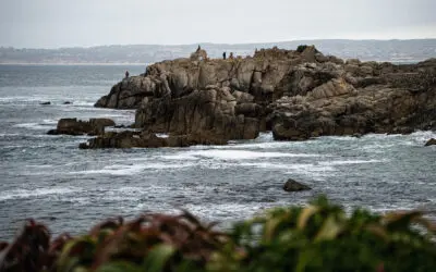
Pacific Grove: the doorway to Big Sur
I’ve lived in California my whole life and had never been to Big Sur — until Highway 1 reopened and I finally made the drive. Here’s how to do it as a first-timer, with Pacific Grove and the brand-new Kimpton Mirador as your home base.

10 Best Cafes in San Francisco by Neighborhood (2026)
San Francisco's coffee culture runs deep—but here's the thing: I used to love Blue Bottle. It was my weekend ritual. Then Nestle bought them. That...
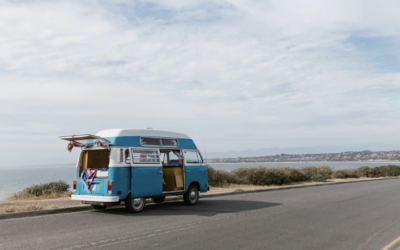
Campervan Travel in US: What It Costs, What to Know, and Whether It’s Worth It
Curious about campervan travel in the US? This guide covers everything from van rental costs ($150-$450+ per day) to where you can legally camp, insurance requirements, and whether the van life is worth the trade-offs—plus insider tips from someone whose parents are full-time campervan travelers.
I read enjoy after reading your article and I decided to enjoy these all things in during my west coast tour, but do you know, for this time, I came back with eastern usa tours. this is very amazing and greatest experience for me.